| |
|
 Geography Geography
Sri Lanka is an island in the Indian Ocean, located to the south of Indian Subcontinent. sprawling over the area of 65,525 Sq. km. The area excluding the inland water 62,336 sq. km. It lies between 6 - 10 of north latitude and between 80 - 82 of east longitude. It has a maximum length of 432 km (Devundara to Point Peduru) and maximum breadth 224 km (Colombo - Sangamankanda) . Sri Lanka with its tear-dropped shape is dominated by the astonishingly varied features of topography, making it one of the most scenic places in the world. Three zones can be divided by its distinguished elevation: the central highland, the plains, and the coastal belt.
A coastal belt surrounds the island, consisting of scenic sandy beaches and lagoons. Best beaches line along the southern coast, southwestern coast and eastern coast. In the northeast and the southwest, the coasts cut across the stratification of crystalline rocks, cliffs, bays, and offshore islands, creating one of the world's best natural harbors at Trincomalee on the northeastern coast and a smaller rock harbor at Galle on the southwestern coast. In the northwest, Mannar Island which is joined with the mainland by a bridge is almost connected to the southern India by a long chain of sandbanks and islets called Adam's Bridge.
 Rivers in Sri Lanka originates in the central highlands, near Adam's Peak and flow through the gorges, broad valley and plains and finally empty in the sea near Trincomalee, creating the different landscapes of escarpments, waterfalls and deep gorges. Most of the rivers are short and frequently interrupted by the discontinuities of terrain. The longest river of Sri Lanka is the Mahaweli Ganga with its length of 335 kilometers. The upper reach of the river is wild and non-navigable while the lower reaches are prone to the seasonal flooding. The river supplies the most important water necessity for the irrigation system in the northeast region in which natural rainfalls are deficient. Rivers in Sri Lanka originates in the central highlands, near Adam's Peak and flow through the gorges, broad valley and plains and finally empty in the sea near Trincomalee, creating the different landscapes of escarpments, waterfalls and deep gorges. Most of the rivers are short and frequently interrupted by the discontinuities of terrain. The longest river of Sri Lanka is the Mahaweli Ganga with its length of 335 kilometers. The upper reach of the river is wild and non-navigable while the lower reaches are prone to the seasonal flooding. The river supplies the most important water necessity for the irrigation system in the northeast region in which natural rainfalls are deficient.
Average Temperature
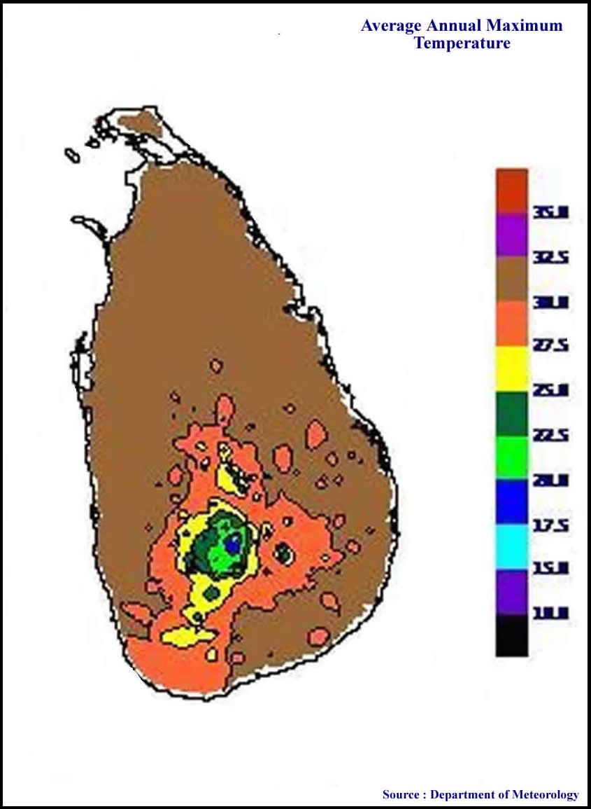
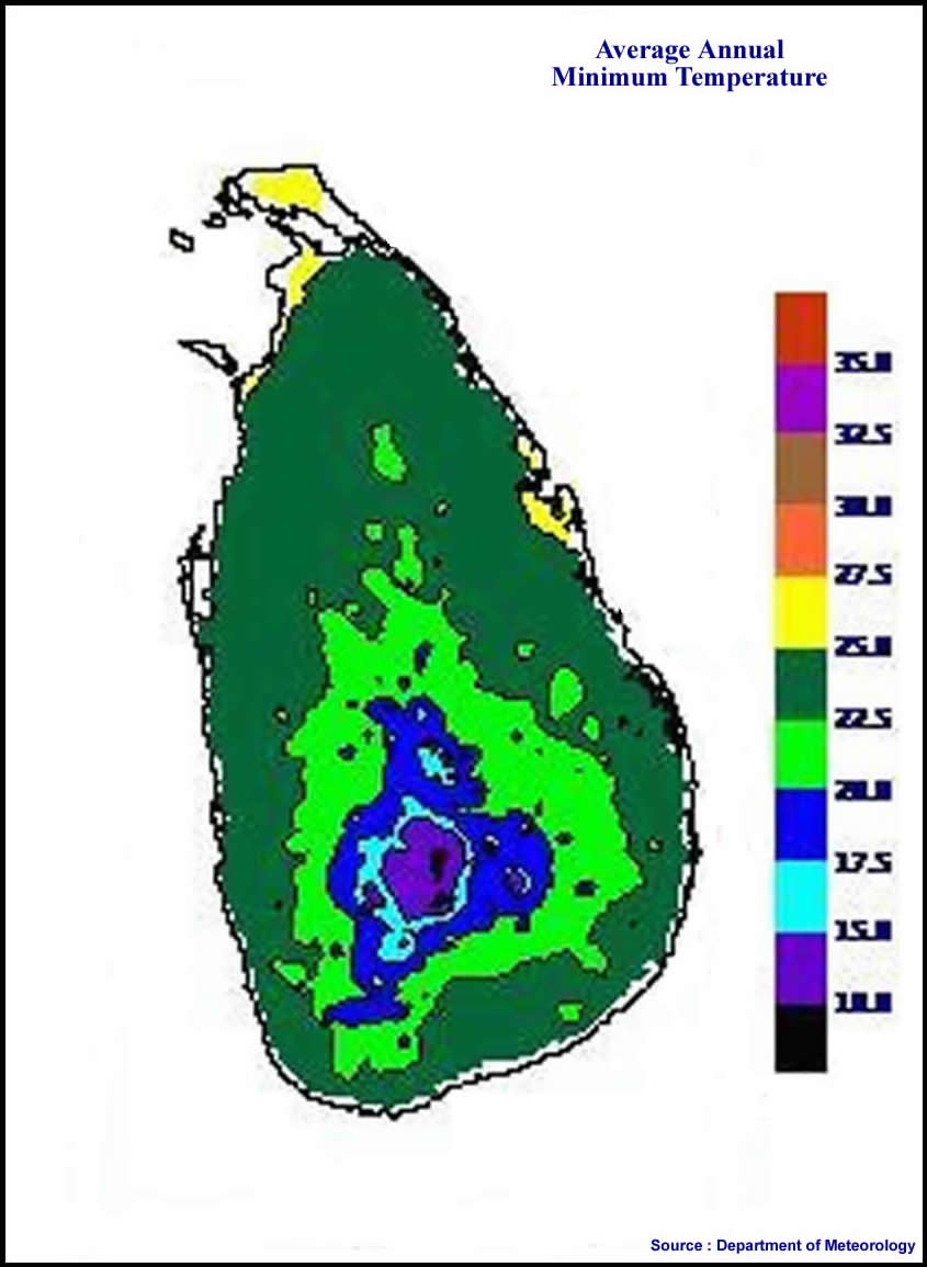
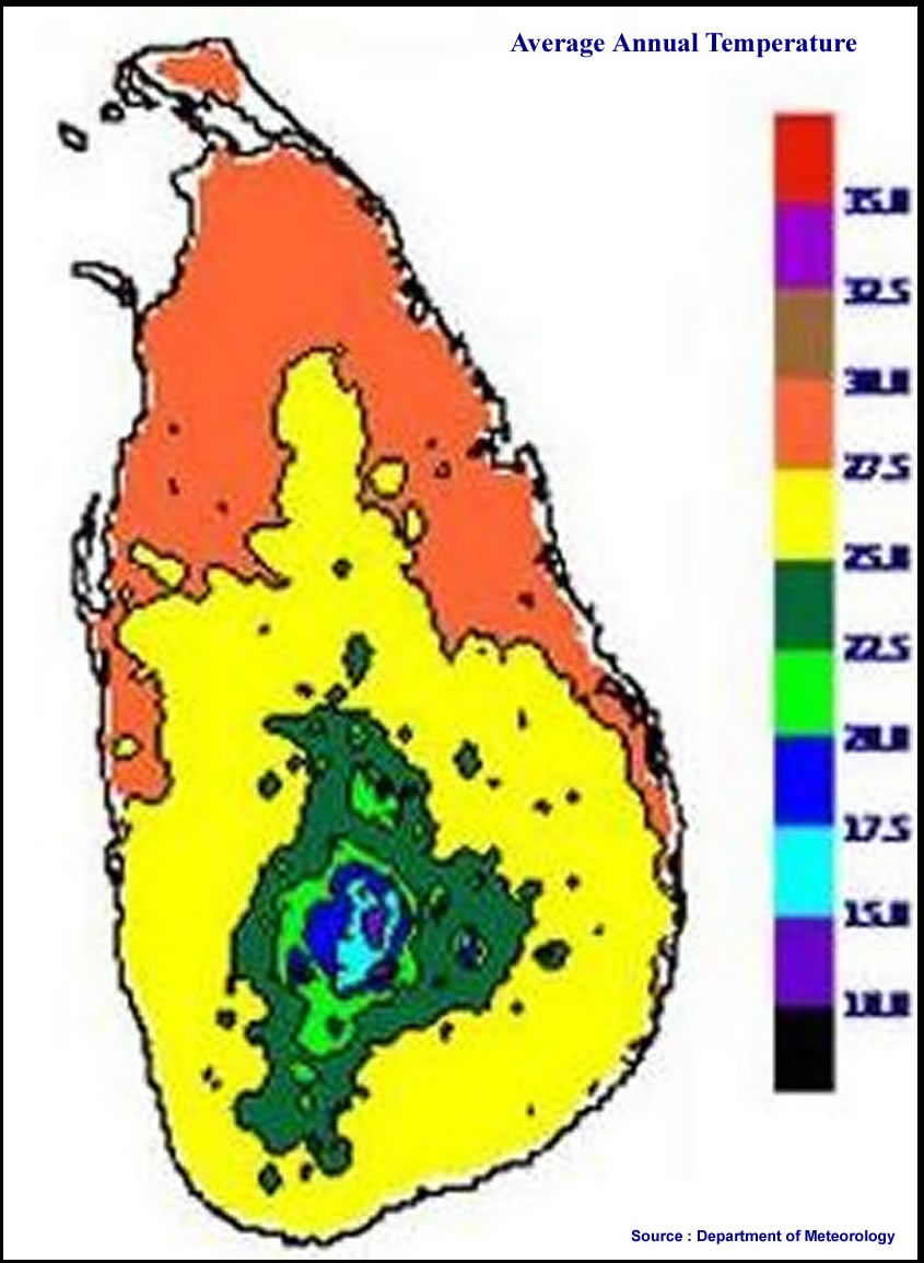
The average yearly temperature in Sri Lanka as a whole ranges from 28 to 32oC. The mean temperature varies from a chilly low of 16ºC in Nuwara - Eliya in the Central Highlands, where even frosting might occur for several days in the winter, to a high of 32oC in Trincomalee on the northeast coast. The coastal areas are cooled by sea breezes.
Monsoons
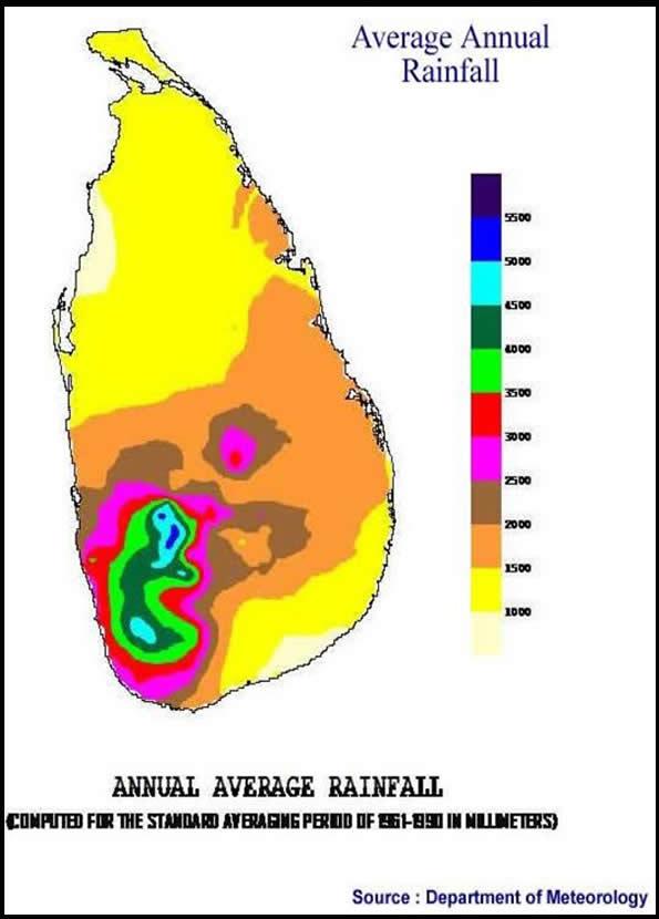
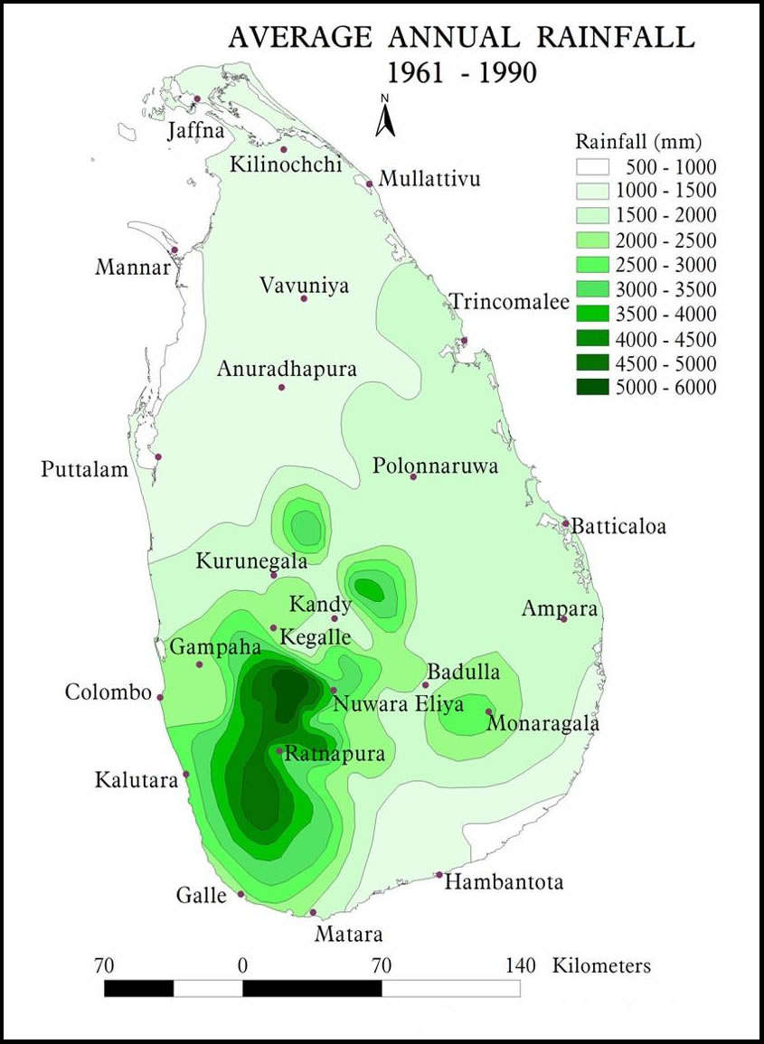
Lying in the equatorial and tropical zone, Sri Lanka is influenced by the monsoons, allowing four distinct seasons. The difference of elevation also influences temperature variation; it is always hot in the lowland and it gets cooler when reaching the higher altitudes. Bright, sunny warm days are the rule and are common even during the height of the monsoon. As for monsoons north-east monsoon brings rain in the northern and eastern regions in December and January while the western, southern and central regions of the island get rain from May to July due to the south west monsoon.
|
|
| |
|
|
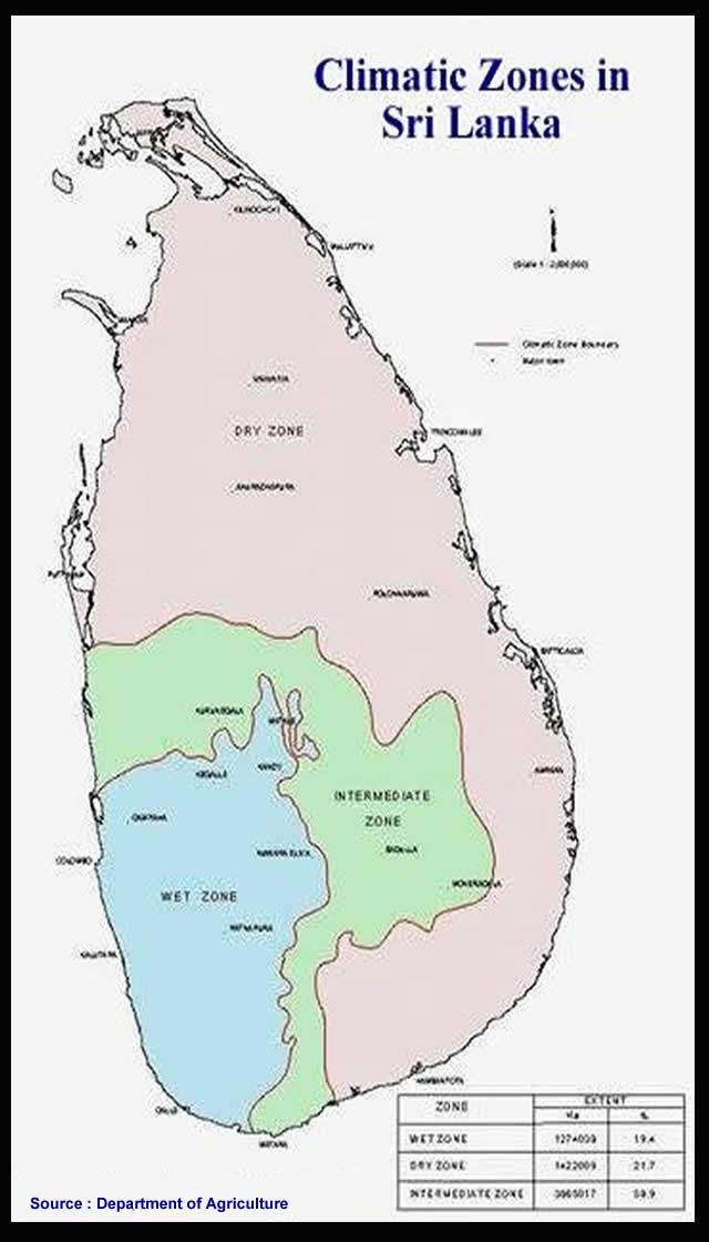
Climatic Zones
in Sri Lanka |
Average Annual
Maximum Temperature |
Average Annual Minimum Temperature |
|